GROUNDWATER EXPLORATION

DISCOVER NEW WATER RESOURCES IN WEEKS.
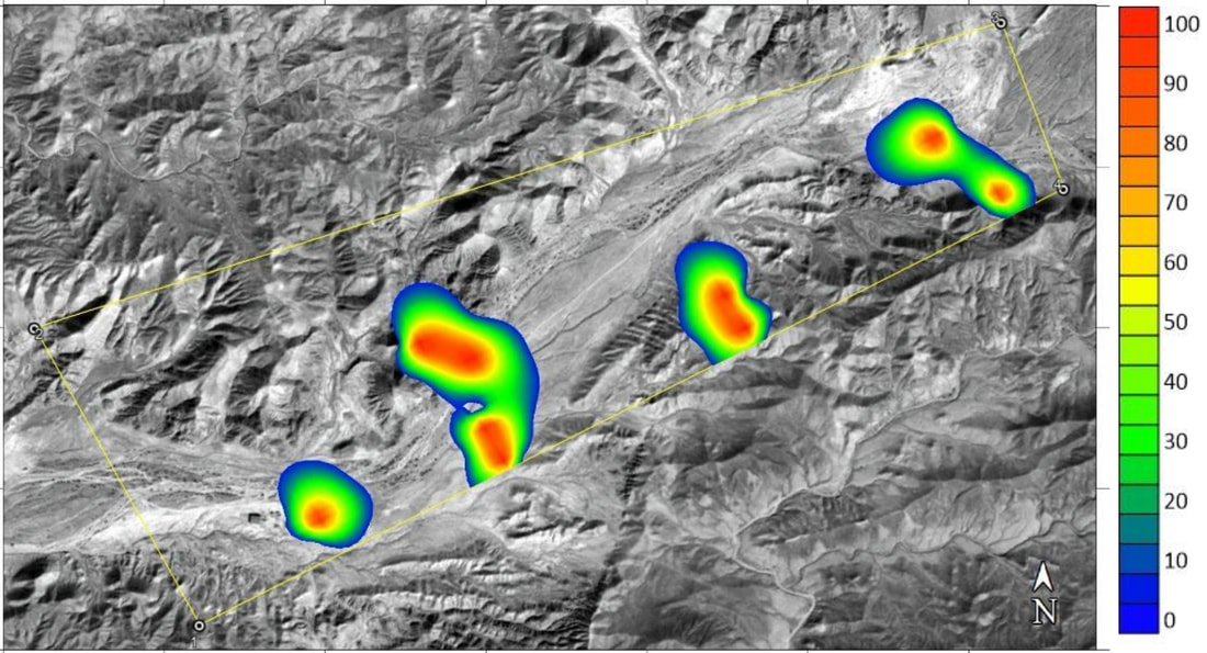
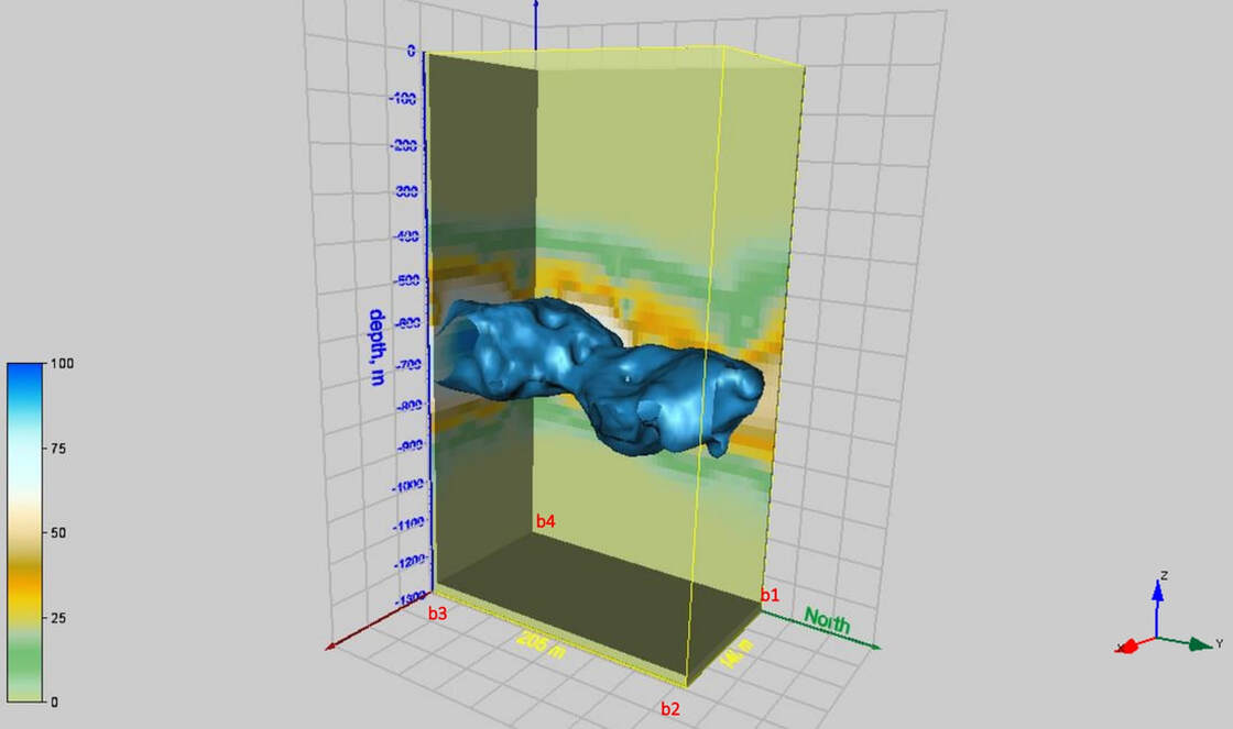
VMF technology is an extraordinary tool for discovering geothermal and groundwater supplies at great depths.
In addition to mapping of aquifers in sedimentary and crystalline rocks and in superficial deposits, we are able to determine chemical composition of the groundwater, detect pollution plumes in groundwater systems, and much more.
In addition to mapping of aquifers in sedimentary and crystalline rocks and in superficial deposits, we are able to determine chemical composition of the groundwater, detect pollution plumes in groundwater systems, and much more.