VMF TECHNOLOGY
  • About VMF
  • Exploration
    • Petroleum Exploration
    • Mineral Exploration
    • Groundwater Exploration
    • Archaeological Investigation
  • News
  • CONTACT

PETROLEUM EXPLORATION

Picture
LEARN THE POTENTIAL OF YOUR DEPOSIT BEFORE YOU DRILL.
VMF reliably identifies Deposit Type Anomalies of hydrocarbons onshore and offshore.

It determines locations and boundaries of hydrocarbon anomalies, their type (oil, gas, gas condensate), number of hydrocarbon-bearing horizons and their occurrence depths from a few meters up to 8 kilometers, faults and hydrocarbons trap.

We measure quantitative characteristics of a hydrocarbon deposit, determine deposit cross-sections, highlight existing reserves and select exact locations for drilling of exploration wells.

​
​>> HIGH-SPEED REMOTE DETECTION OF RESERVES OF OIL AND GAS FIELDS.

When searching and delineating oil and gas fields, the total spectra of dozens of main hydrocarbon compounds are used, accurately showing the location of hydrocarbon deposits. The depth of scanning for oil and gas fields is from a few meters up to 8 km. VMF method is the scientific exploration method, based on the capture and processing of direct spectral signals of elements constituting real hydrocarbon deposits. We identify the hydrocarbon directly, unlike other exploration service companies that only detect rock formations that potentially could contain hydrocarbon.
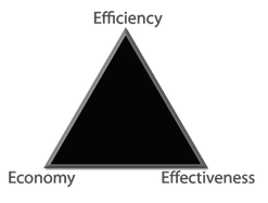
>> ECONOMIC EFFICIENCY FOR PETROLEUM EXPLORATION
VMF allows to formulate a strategy for the development of mineral resources in the regions, determine the significance of concessions in the purchase or sale, significantly reduce the volumes of non-productive drilling and improve the efficiency of geological exploration. 
Picture
  • Eliminates dry wells once and for all;
  • Eliminates cost in case of complex geographical conditions;
  • Eliminates cost of time (inflation, risks, etc.);​
  • Eliminates cost of environmental protection, land reclamation, etc.;
  • Eliminates cost of drilling a large number of exploratory and development wells.
PAST PROJECT SAMPLE
>> ​Creating 2D model of the oil deposit
This Report reflects the outcome of a scientific research done to locate the accumulation points for Oil on the plot of Customer`s license area. The research is done by using the VMF analysis (Verification of Multispectral Forecast) based on the sequential use of mathematical and multispectral analysis of the satellite image which allows to locate Oil deposits by studying concentration of the following elements: С, H, S, N.
​
>> ​Creating 3D block model of the oil deposit
The purpose of the work at this stage: the construction of a deep geological 3D model of the hydrocarbon field and the assessment of the estimated Oil resource in this area. 
VMF has the capability to calculate the Volume of Oil
VMF POSSESSES THE MOST ADVANCED TIME-SAVING AND COST-SAVING SERVICE IN EXPLORATION OF NEW RESERVES. 
Picture
Home 
Petroleum Exploration
Mineral Exploration
Groundwater Exploration
Archaeological Investigation
News
Contact
VMF is exploration via Satellite, the world's most advanced Exploration Service Provider. We can search for any Commodity (Minerals, Oil & Gas, Groundwater), Onshore and Offshore, with 98% Accuracy. VMF is your express tool for finding new reserves.​
Copyright @ 2015 to 2023 VMF Technology | All Rights Reserved 
  • About VMF
  • Exploration
    • Petroleum Exploration
    • Mineral Exploration
    • Groundwater Exploration
    • Archaeological Investigation
  • News
  • CONTACT