MINERAL EXPLORATION

METAL BASED MINERALS & KIMBERLITE PIPES. ANY TERRAIN. ANYWHERE.
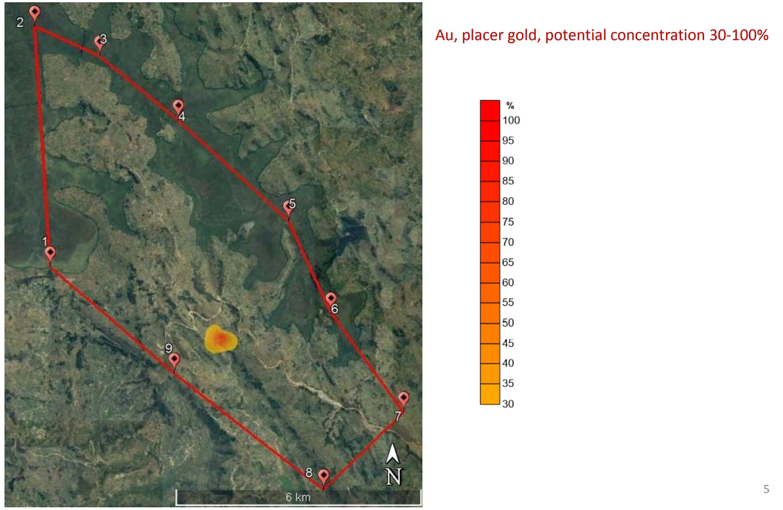
Remote Sensing by VMF is an unmatched exploration tool for direct identification of mineral deposits.
We show the exact location of the targeted minerals, the occurrence depths of ore bodies down to several kilometers, build deposit cross-sections and produce recommendations for drilling programs.
We show the exact location of the targeted minerals, the occurrence depths of ore bodies down to several kilometers, build deposit cross-sections and produce recommendations for drilling programs.